University of Reading cookie policy

We use cookies on reading.ac.uk to improve your experience, monitor site performance and tailor content to you

Read our cookie policy to find out how to manage your cookie settings

18th century map of Langley Mead in Shinfield

Ancient landscape

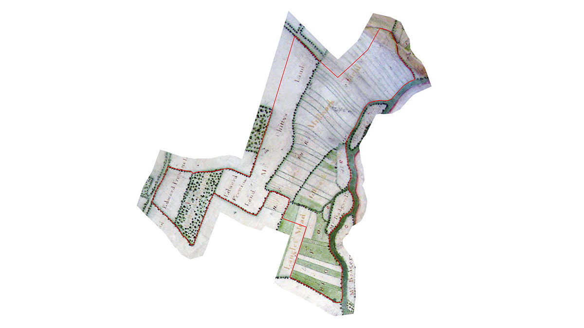
Old maps dating back as far as the Earl of Fingal’s Estate Map of 1756 show the landscape of Langley Mead as being typical of an ancient landscape; enclosed fields, old hedgerows, wildflower-rich meadows, pasture and common land. The site even once supported an ancient coppiced woodland known at the time as "Costrill’s Coppice", that would have been an important part of the local economy.

This landscape would have been traditionally managed in a low-intensity way, and would have been much more biodiverse.

Post-war land use

From the Second World War, farmers had to make major changes to the way they farmed the land. This was in order to produce larger quantities of food cheaply to keep the country fed. This intensification of agriculture had a major effect on the countryside across the United Kingdom.

Environmental concerns

In 1984, the Joint Nature Conservation Committee reported that 97% of all of the semi-natural grassland (which includes wildflower-rich meadows) in lowland England and Wales had been destroyed over the previous 50 years, with losses continuing at 2 to 10% of the remaining resource each year. At that point, they estimated that there was less than 1,500 hectares of species-rich floodplain meadow remaining in the UK.

Langley Mead reflects this national pattern. The old meadows, which would probably once have been very wildflower-rich, have since either been ploughed up or biologically impoverished due to modern agricultural techniques, and Costrill’s Coppice was cut down and cleared at some point in the twentieth century.

Restoration and recovery

Despite its past losses, Langley Mead has been identified as having a special potential to be restored to its former wildlife-rich condition. Because of its location on the River Loddon floodplain, it has not been farmed quite as intensively as other areas and still supports some species that are relicts of its past. Plants like meadowsweet (a natural source of the chemicals used to make aspirin and antiseptic) and yellow flag iris still inhabit some of the wet ditches, and a line of old willows that show signs that they were once pollarded as part of their old management has survived in a field known as "Millworth Moor".