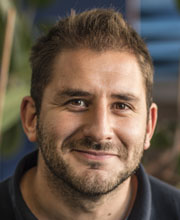
Rob Fry

-
+44 (0) 118 378 7972 (Internal 7972)
-
Lecturer
Areas of interest
Geophysical survey, interpretation, data processing and analysis. GIS support.
Rob is responsible for a variety of field-based geophysics projects which support the research and teaching programme of the school. The range of activities is wide and includes:
- organising geophysical survey
- maintaining geophysical and surveying equipment and software
- processing data
- the creation of graphical output such as geophysical interpretations and published detailed reports.
Rob is also involved with the teaching and mentoring of students for related research.
Research centres and groups
- International Society for Archaeological Prospection (ISAP)
- Detection of Archaeological Residues using Remote Sensing Techniques (DART)
- Interactions between Soil Science and Geophysics in Archaeological Prospection (ISSGAP)
- Walker Institute
Background
Rob has worked in archaeological and shallow geophysics for 10 years in both commercial and research organisations, during which time he was a prominent member within the Management Committee for the International Society for Archaeological Prospection (ISAP).
Rob was the Project Officer for the Silchester Mapping Project, based at Reading University, and has surveyed many hundreds of hectares within and around the Roman Town of Calleva. He has also worked as a geophysicist for The British School at Rome, Wessex Archaeology, Archaeophysica, and Earthsound Archaeological Geophysics.